|
|

|
 What
do land surveyors/geodetic engineers do other than stand behind a transit and wave their arms at other people that we can’t
see, cut our cared fruit trees, or set up traffic cones and road barriers that force us to change lanes and drive through
a watery pot hole? The answer is simple. Understanding it is not. Surveyors
mark the boundaries of land, create maps and legal descriptions, and plan and organize the development of property. The land
surveyor/geodetic engineer’s responsibility is synonymous with one of the man’s basic right-- THE RIGHT TO SECURITY
OF ABODE. We deal
with a lot of important issues in our lives but the three that seem most timeless and universal are our families, our health,
and our rights to our land. Our welfare is directly affected by our ability to define our space. That’s one of the land
surveyor’s most important jobs, to mark, describe, and map property ownership. His or her work creates a stable framework
on which we can build our homes and communities, and generate the wealth necessary to sustain those communities. If we don’t
know the location of the boundaries of our land we can’t enjoy any unique use of it. We could not buy, sell, mortgage
or develop land in an orderly and predictable fashion. The land surveyor provides that knowledge. Although
the rules of land surveying may vary depending on the place where you practice, or in the Public Land Survey System, There’s
one fundamental principle that governs our work. In the words of Justice Cooley of the Michigan Supreme Court, “No man loses title to his land or any part of it merely because the evidence of
where it once was becomes uncertain.” The perpetuation of property rights and title is tied to the land. Land
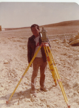
surveyors use computers, precise measuring tools, and mapping systems to gather and analyze data (evidence) in the field.
They then interpret that data to establish the most probable location for property corners. Their opinions are formed from
knowledge of common law, rules of evidence, state and federal laws, and local standards of practice. In many ways it is much
an art as it is science. Another
important part of the land surveyor’s professional activity involves understanding and “decrypting” the
often-confusing language in legal descriptions. Just what did the author of the deed mean to convey? If you really want to
get a land surveyor talking, ask him to describe how many different ways there are to go “North.” The list is
probably similar to the number of words for snow in the Inuit language. Despite
the fact that there are a lot of flashy new tools available now to make expert measurers out of novices, we will never really
know the true location of boundary lines if we don’t understand the value of what is being measured. That is the expertise
of the land surveyor, and one of the reasons that you may see someone carrying a red and white pole peeking under the sod
in your front yard.
|
